
Methane Fugitive Emissions Surveys
As investors and shareholders are actively demanding companies to reduce emissions from within their own organization, as well as from their suppliers and end-users, the need to efficiently detect and accurately quantify methane fugitive emissions is becoming more and more important, as methane is a potent greenhouse gas.
Detection of methane fugitive emissions using drones has numerous applications and advantages when compared to the surveys conducted from the ground.
![]()
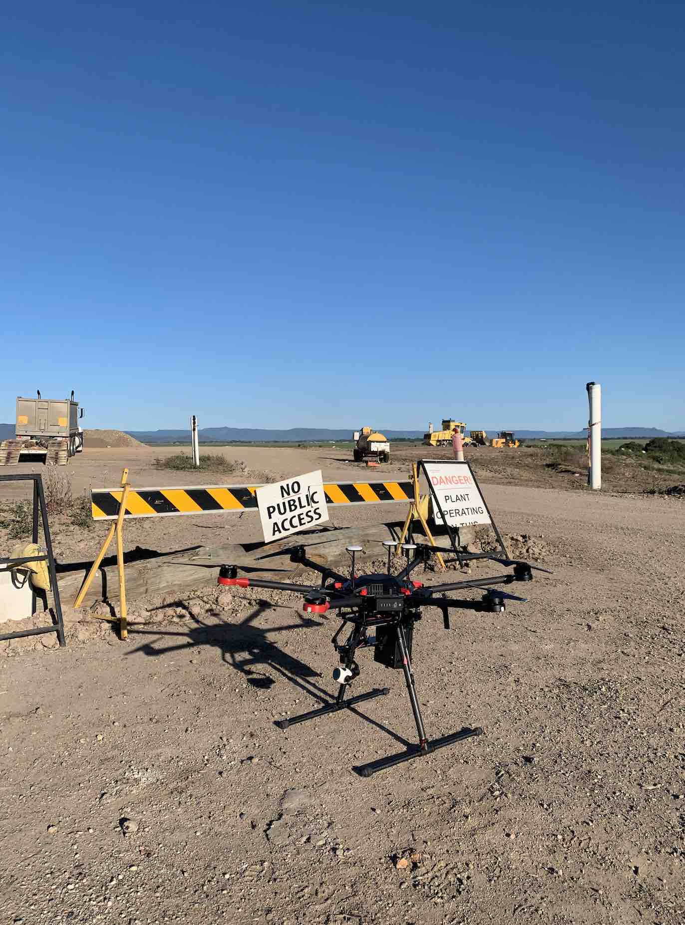
 Terra Sana Consultants provides methane fugitive emissions detection using drones equipped with a sensor able to instantaneously detect methane concentration and geo-reference the results.
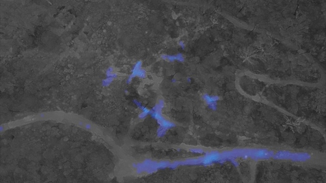
Using geostatistical analysis, the data can be mapped to display the locations of the methane detections within an hour from landing the drone.
Industry applications:
Landfill gas
 To comply with the environmental legislation, landfills’ operators are required to undertake regular methane fugitive emissions monitoring. Landfill gas monitoring is normally conducted by a walking survey carrying handheld detectors. This is not a safe and efficient approach. Personnel walking on landfills surface can be exposed to toxic emissions and dust, are required to walk on uneven ground, nearby exposed refuses.
The data produced during a walkover survey are normally lacking georeference, therefore large areas are normally missed due to access restriction, sensor delay response time and human bias. Detectors used for landfill gas monitoring are normally fitted with a pump that withdraws a sample of ambient air and carries it to a sensor. There is a delay of several seconds between the sampling and the sensor response time. This delay makes difficult and inaccurate to re-trace back the detection to an exact location. TSC drones provide a safer and more efficient approach to landfill gas monitoring. The operator is not required to access the landfill area, a data point is collected every 0.1 seconds and each data point is geolocated. The flight path is reproducible so each survey can be comparable with the previous.
Coal seam gas
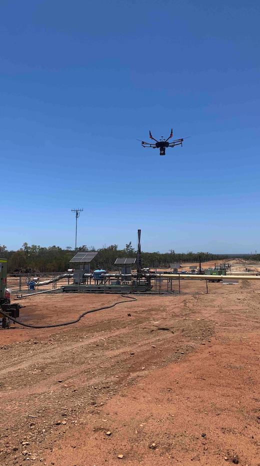 CSG infrastructures like gas pipelines, wellheads, vents, and flares require regular fugitive emission surveys to plan the correct maintenance and assure safe operating conditions. Methane detection conducted from drones can provide a cost-effective, safe alternative to a drive survey. Difficult to access area can be easily reached with the drone.
Gas seeps are naturally occurring systems where gas escape to the surface, normally under low pressure. Methane detection using drones is an efficient method to identify and characterize gas land seeps.
Legacy boreholes are normally historic exploration holes on land where the tenure has now ended or changed. In recent years, the relevant government departments developed codes and standards to outline the requirements regarding abandonment of existing exploration or production bores, but these requirements were not in effect for historical bores.
These boreholes represent a liability if they have not been properly rehabilitated by the previous authority holder. TSC can successfully identify and geolocate legacy holes.
Mining
Fugitive methane detection using drones has been successfully used to identify methane surface emissions from underground mines. Methane fugitive emissions collected above the ground surface of underground coal mine have been correlated with underground goafs oxygen measurements.
The oxygen in the air once underground can interact with the residual coal in the goaf. This can lead to a rapid escalation of a spontaneous combustion event.
Spontaneous combustion in the goafs of longwall is a serious hazard with the potential to lead to mine abandonment or prolonged production suspension. Investigations of past incidents have identified air passages created within the coal mine, due to the overlying strata fracturing and subsiding with the advancement of underground tunneling, as one of the possible causes of spontaneous combustion.
Biogas
The avoidance of methane emissions is very important in biogas operations to assure plant safety, environmental sustainability and avoid revenue loss. UAVs can provide a reliable inspection and measuring tool to identify any plume.
Water Sampling Drone
Terra Sana Consultants has developed a water sampling system for remotely collecting water samples using a drone. This system greatly reduces the risks involved in collecting water samples from tailing dams, pit lakes and crocodile-infested rivers. This also presents a significant resource-, logistic-, and cost-saving opportunity.
- Eliminates many site hazards to the field staff involved in water sampling as the operator can remain at a safe distance from the water body
- The system uses a winch system to lower and lift the water sampling container, greatly enhancing flight safety
- The system has been designed with multiple redundancies to ensure safe operations such as a quick release system that can be triggered in case of an entanglement
- Samples can be re-collected at the same exact location using high-precision GPS
- Up to 5 samples can be collected in a single drone battery set, greatly increasing the efficiency of sampling; and
- The operator has a live view camera feed of the water sampling device.
Thermal Imaging Surveys and Inspections
Thermal allows you to spot problems before they become serious
Underground coal fire
Infrared inspection, or thermography, is used throughout the industry as a key diagnostic tool for finding problems. Infrared inspection is a non-destructive, non-contact and cost-effective way to detect and document hot spots before they become serious.
- Building diagnostics: Find areas of heat loss, missing insulation, and other damage
- See water damage not visible with the naked eye
- Search and rescue: Find fire hotspots, missing people and animals day or night
- Gas leak detection
- Electrical inspections: solar panel inspections, electrical defaults and powerline inspections.
Get imagery beyond the visual spectrum, a whole new vantage point using Infrared Spectrum.
Spontaneous combustion from underground coal fires
Spontaneous combustion of coal and resulting coal fires causes a huge waste of energy, halting mine production and producing harmful gases that are life-threatening to workers and local residents. Its by-products, the greenhouse gases such as CO2 and CH4, exacerbate global warming. Underground coal fire has also led to surface subsidence and produced a large number of surface fissures. Thus, the early detection of coal fires and their spatial distribution is crucial so that the fire disaster can be prevented as early as possible.
Terra Sana Consultants have demonstrated that the application of UAV-borne thermal imaging provides a quick, efficient and safe way to detect, visualize and describe the spatial distribution of underground coal fires. Areas otherwise not accessible, due to topography or fire-induced cracks, for instance, can easily be investigated without putting workers at risk. In combination with our airborne methane surveys and 3D mapping (for subsidence monitoring) services, we can provide an integrative assessment for investigation purposes.
Thermal mapping of landfills for the early detection of waste fires
An area of elevated temperature within a landfill could indicate sub-surface smouldering with the potential of a spontaneous combustion.
Terra Sana Consultants utilises state-of-the-art thermal cameras attached to drones to quickly and effectively to identify potential hotspot locations. Using surface temperature data stored in the imagery, a whole-of-site thermal map can be created to spatially locate ares of high temperature readings that require further investigation. This spatially accurate thermal map can also be overlaid onto a RGB 3D map to give a virtual, interactive view of the increased temperature locations which can be compared flyover to flyover.
By proactively identifying hotspots before they turn into fires, the potential for large-scale remediation costs are significantly reduced. As the axiom goes, prevention is better than cure.
3D Mapping
Geo-referenced orthomosaic maps, aerial surveys, volumetric analysis, 3D modelling, elevation plots, slope analysis, etc.
- Geo-referenced orthomosaics
- Photogrammetry (volumetric and slope measurements)
- Point cloud generation (3D modelling)
- Digital surface modelling (DSM)
- Digital terrain modelling (DTM)
- Project progress photography
- Volumetric and stockpile analysis
- Environmental impact assessments
- Watershed analysis
We also offer powerful cloud-based tools, enabling you to measure lengths, areas and volumes, track changes over time, and share your data with ease.
Asset Inspection
Construction Site Progress

Construction site progress documentation is essential for every general contractor. Whether you need to share the state of a project with clients and stakeholders, monitor site changes over time, or dispute claims down the road—you’ll need to capture progress photos over the course of a project.
Infrastructure Inspections

Using optical and thermal cameras, our drones can capture close visual inspections of building roofs and facades to quickly spot defects such as leaks, damaged tiles, brickwork, corrosion, concrete cancer, cracks & window structural issues.
Exploration Bores Inspection

Terra Sana Consultants provides support to locate legacy bores, assess the surface rehabilitation status using the latest drone imagery and determine if the bores are emitting methane using specialised drones.
Training, Consulting and R&D
We are strongly focused on innovation, best practices and customised solutions. This reflects on our intense R&D program involving the use of drones and advanced technical instrumentation to conduct field surveys. This approach allows us to deliver robust scientific data and comprehensive reports to enable the best decision making.
Develop your own drone data capability with our training, consulting and development services in partnership with Ace Aviation.
- Photo & video aerial training.
- Aerial mapping & surveying
- Precision agriculture
- Aerial thermal imaging


